When you think about land surveying, you don’t necessarily think treasure hunting, but sometimes they dig up gems that, while maybe not worth a lot of money, are worth a lot of historical value.
There are stories of surveyors finding civil war bayonets, fossils, old coins, and more. SCTCC Land Surveying/Civil Engineering students got to learn about treasure found right here in Minnesota.
During the Minnesota Society of Professional Surveyors Central Lakes Chapter meeting on Sept. 24, surveyors from Bonnema, Runke, Stern shared the story of a treasure find. But first, a little historical context.
In the mid-1800s, the government marked one-mile property corner grids as part of the Public Land Survey System (PLSS) to be sold by the government and divided into smaller parcels.
When the section markers were being set, many times there were no natural indicators of where it was located, so the surveyor would build a mound on the north, east, west, and south sides of the marker. As you can imagine, over time these mounds disappeared. The markers themselves were placed on the ground, but many were removed for agricultural reasons, and roads covered others, preserving the marker.
One thing to keep in mind about the original markers is that they are the true location of the section corner for the federal government. Over time, if survey lines have an error on the corner, it must be set back to its original location.
Even as early as 1900, the government realized that the markers that had mounds to mark them were eroding, so they began the process of resurveying and placing stones or other more permanent items at the original section corner markers.
Then the Great Depression happened, and it came to a standstill. Not to mention, these markers are every half mile in the US west of Ohio. Land Surveying instructor Jake Mackedanz estimated tens of millions of these markers exist in the PLSS. Because of the large undertaking, the federal government decided to turn over the maintenance and authority of the records to each state.
While surveyors are supposed to report to the state each time they encounter a marker, whether a private or public project, it’s not a perfect system, and over time, records have been lost.
In 2023, the Minnesota Society of Professional Surveyors realize that the loss of records has turned into a real problem. Many section corners in the rural part of the state may not have any records since the early 1900s. Following the lead of several other states, they proposed to congress a re-monumentation project, and the grant was approved on a three-year trial.
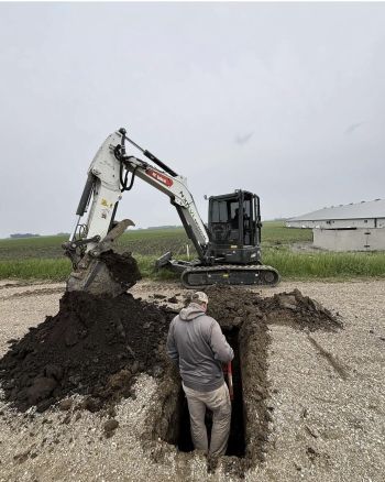
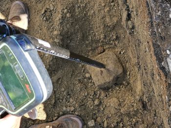
Mackedanz has worked on this project in Swift and Renville counties. Sometimes they find modern monuments on the surface, but if they have a record of the original, the surveyors need to dig below the modern monument to search for the original location.
“It’s part archeology, part mathematics, and part record research,” Mackedanz explained.
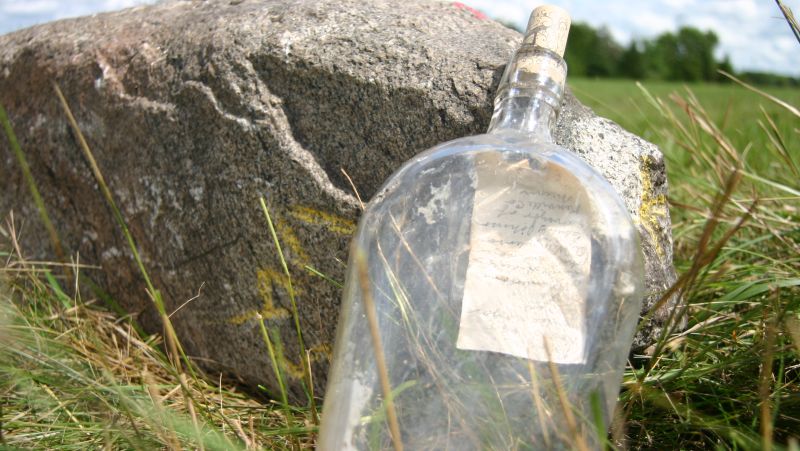
During the chapter meeting that SCTCC attended, surveyors explained the re-monumentation progress in Chippewa and Yellow Medicine counties. Once in a while they do find treasure and shared photos from the dig where they found old bottles buried alongside the section marker that contained notes from the original surveyors.
Because the bottle had been preserved underground in a bottle, the note inside didn’t look like it was nearly 200 years old.
“It’s really cool that they’re using all these old records that are around from the 1800s to find these, and they’re actually finding them,” said Land Surveying / Civil Engineering student Andrew Mead.
The project will likely take up to another 30 years to complete, which means current and future SCTCC students may have the opportunity to work on the re-monumentation of the PLSS markers. Aspiring treasure hunters are always welcome to check out Land Surveying/Civil Engineering!